Ditch & Canal Management
Software + Sensors
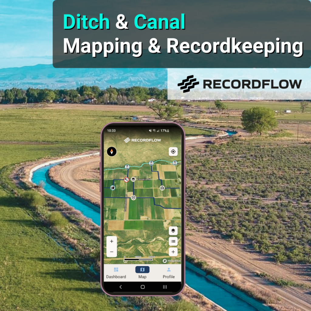
Your Ditch and Canal Maps Notes Photos Documents Measurements Sensors - Accessible Anywhere
Your Water - One Platform
As the ONLY water management platform built specifically for ditch and canal systems, RecordFLOW simplifies and streamlines the collection of water & operations information and builds simple tools to help you make sense of this data and information. From individual farm fields to huge irrigation districts, our customers trust RecordFLOW to streamline and simplify their water management data.
Our tools are simple, secure, powerful, and packed full of features designed to give you real-time information on your water delivery systems while also providing you with an organized, map-based recordkeeping structure for long-term recordkeeping.
Sure, there are other mapping software, recordkeeping software, and water measurement tools – but only RecordFLOW pulls all of these under one roof.
Efficient. Easy-to-Use. Powerful. Our promise, to you.
Right Tool - Right Job
RecordFLOW Helps You
Create
Create your own maps and dashboards using simple, custom workflows for ditch and canal systems.
Collect
In the field or at the office, we make data collection easy.
Connect
Your ditch and canal maps, data and information are always just a click away.
Control
You control your data. Give access to those that you trust.
Who Uses RecordFLOW?
- Individual Water Rights Owners & Shareholders
- Mutual Ditch Companies
- Irrigation Districts
- Drainage Districts
- Irrigation Laterals
- Ditch Riders
- Board Members
- Farmers
- Ranchers
- District Managers
- Engineers
In the field or at the office, RecordFLOW is always ready to work for you.
About Our Company
American Owned: Based in Colorado, USA
Our company, and the software, was born from the personal and professional experience or our CEO, Blake Osborn. In his work with ditch companies, it was a challenge to find the right tools to help his partners pull together the “big picture” of water data and information. They needed tools that go beyond just water accounting and flow measurements. They needed tools to help capture information to make efficient decisions now and protect their interests for the future. That tool didn’t exist, so we decided to build one.
RecordFLOW exists to help water managers, water users, and water rights owners save time and money with simple, easy-to-use decision support tools. We build tools to help you capture and create your own cache of private water data you can call upon if you ever need to protect your water rights.
At RecordFLOW, we don’t consider ourselves a technology company, we’re a water management company that leverages technology to build tools to help our customers be more efficient and build organized data for greater legal protections. Learn more about our company, and please feel free to reach out to us if you have any specific questions.
GET STARTED TODAY
Ready to Start Your Free Trial?
RecordFLOW gives you the safe and secure platform to keep your water information private, improve your operations, and protect your water rights.
Take control of your water Data and Information today.